HOTELS
HOTEL RADDISON
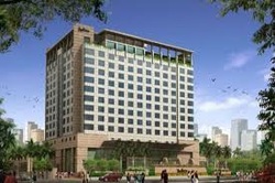
THE NEAREST HOTEL OF KHUJNER IS HOTEL RADDISON INDORE DISTANCE 165 K.M.
HOSPITAL
THE NEAREST HOSPITAL DIST. CIVIL HOSPITAL RAJGARH DISTANCE 30K.M.
RAILWAY STATION
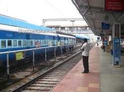
THE NEAREST RAILWAY STATION IS PACHORE DISTACE 16 K.M.
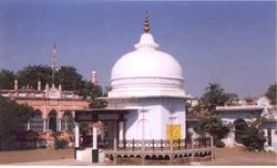
HISTORICAL PLACES --
DARGAH OF RAJGARH
The District takes its name from the headquarters town Rajgarh. Rajgarh District was constituted after the formation of Madhya Bharat in May, 1948. Prior to this the area of the present District was parceled out among the States of Rajgarh, Narsinghgarh, Khilchipur, Dewas (Senior) Dewas (Junior) and Indore. Rajgarh was the headquarters of a mediatised State, ruled by the Umat Rajputs and branch of the great paramara clan, they enjoyed a Sanad Estate under the Sultans of Delhi and Mughal emperors in succession. The first capital was Duparia, now in Shajapur District. Later on it was shifted to Dungarpur (19 Km from Rajgarh) and then to Ratanpur (19 Km. west of Narsinghgarh) and back. Inorder to avoid disturbance by the frequently passing Mughal armies, the Ruler of the Estate, Mohan Singh, acquired the present side, originally known as Jhanjhanipur from the Bhils in A.D. 1640. Finally he shifted the headquarters in the year 1645, giving the place its present name.
During the reign of Akbar (A.D. 1556-1605) a Khilat and a Sanad were granted to Udaji of Tatanpur. At that time, Sarangpur was a Sarkar in the Subah of Malwa. Its jurisdiction extended from the western part of present Sehore District to the eastern part of Ujjain District. Among its twentyfour mahals many have retained their original names and are identified as Ashtah, Talain (Talen), Agra (Agar), Bajilpur (Bijilpur), Bhorsah, Khiljipur, Jirapur, Sarangpur, Sondarsi (Sundarsi), Sosner (Sunner) Sajapur, Kayath and Navgam (Tarana)1. In 1908, Rajgarh State was divided in to sev
During the reign of Akbar (A.D. 1556-1605) a Khilat and a Sanad were granted to Udaji of Tatanpur. At that time, Sarangpur was a Sarkar in the Subah of Malwa. Its jurisdiction extended from the western part of present Sehore District to the eastern part of Ujjain District. Among its twentyfour mahals many have retained their original names and are identified as Ashtah, Talain (Talen), Agra (Agar), Bajilpur (Bijilpur), Bhorsah, Khiljipur, Jirapur, Sarangpur, Sondarsi (Sundarsi), Sosner (Sunner) Sajapur, Kayath and Navgam (Tarana)1. In 1908, Rajgarh State was divided in to sev
